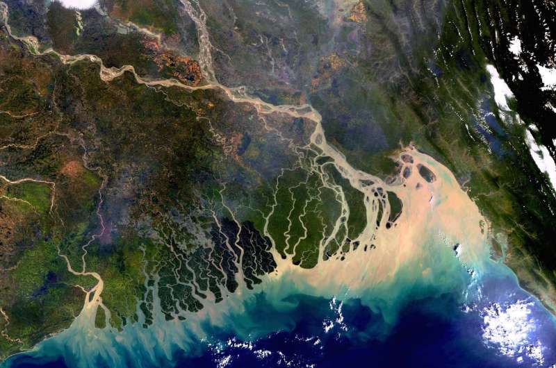
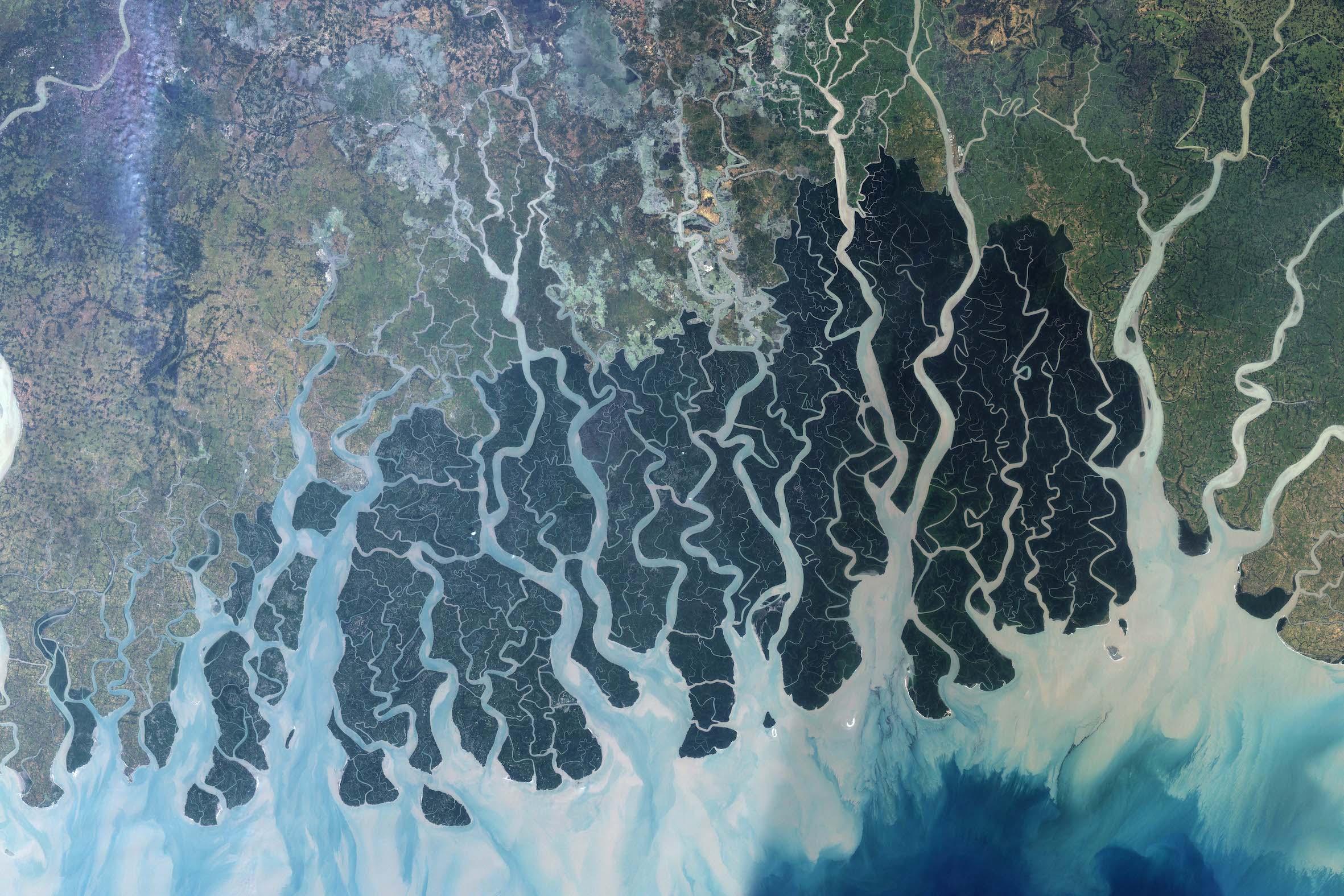
AHYDTECH Water Resources (BD) Ltd. is a sister organization in Bangladesh working in water resources, river morphology, hydrology and hydraulic. We are working on all the rivers and river systems of Bangladesh including the Padma, Meghna and Brahmaputra-Jamuna basins. We have been developing HEC-HMS hydrological models for the three major basins – Ganges (1,087,300 Km 2 ), Brahmaputra-Jamuna (552,000 Km 2 ), and Meghna (82,000 Km 2 ). These three basins together are one of the largest river basin systems of the world. The HEC-HMS models are being calibrated using observed flow data. The calibrated models will be used to simulate flows at subbasin outlets for water resources management, river dredging analysis, river morphology and bank erosion assessment, hydraulic and sediment transport analysis, natural channel design and river training.